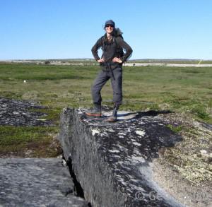
 Katerine Grandmont
Primary Address
Department of Geography
Strathcona Building, room 440
Université de Montréal
520 chemin de la Côte-Sainte-Catherine
Montreal, Qc, Canada, H2V2B8
Email: [email protected]
Project Title
Using geographic information systems for risk-assessment planning in permafrost environments. Case Study: Tasiujaq, Nunavik, Quebec
Description of the project research
Northern regions underlain by permafrost will undoubtedly be impacted by the projected increase in air temperature. A growing number of structures that were once built with great confidence on perennially frozen soils are already starting to show signs of degradation. Permafrost degradation (e.g. active layer deepening) can lead to significant thaw-settlements, thermo-erosion and mass-movements. These processes can cause important damages to infrastructure and require high costs of repair. The actual climatic context therefore commands that the implementation of projects in permafrost regions follow a well-thought planning in order to account for the potential impacts of permafrost degradation.
My research focuses mainly on risk-assessment for land-planning purposes. Using a GIS-approach, I have been working on developing a methodology to produce risk-assessment maps to help communities better plan their built environment.
Permafrost stability must be seriously taken into account for any selection of suitable land on which to safely and sustainably build infrastructure. Changing permafrost landscapes are really active in terms of geomorphological processes and require a good understanding of the many factors that interact in the geosystem. A multi-scale analysis of the landscape is necessary and should include the investigation of surficial deposits, topography, as well as permafrost, vegetation and drainage conditions. The complexity of all the interactions that shape the landscape is such that it is practically impossible to account for all of them or precisely anticipate the response of the system following disturbances. This reality, combined with the subjectivity involved in the process of mapping, has also brought me to develop a methodology to quantify uncertainty in the resulting risk-assessment maps.
Keywords: Land-planning, permafrost, geographic information system (GIS), multi-criteria analysis, climate change
Scientific articles in peer-review journals & conferences
Grandmont, K., Cardille, J.A., Fortier, D. (2012) Multi-criteria evaluation with geographic information systems in changing permafrost environments: Opportunities and limits. Fifteenth International Specialty Conference on Cold Regions Engineering, Quebec, Canada, August 2012: 666-675.
Grandmont, K., Cardille, J.A., Fortier, D., Gibéryen, T. (2012) Assessing land suitability for residential development in permafrost regions: A multi-criteria approach to land-use planning in Northern Quebec, Canada. Journal of Environmental Assessment Policy and Management, 14(01): 73-9
Conference presentations
Grandmont, K., Cardille, J.A., Fortier, D. (2012) Multi-criteria evaluation with geographic information systems in changing permafrost environments: Opportunities and limits. 15th International Specialty Conference on Cold Regions Engineering, August 21st 2012, Quebec, Canada
Conference posters
Larrivée, K., Fortier, D., Grandmont, K., Allard, M. (2012) Estimation de la stabilité du pergélisol : étude de cas à Puvirnituq, Nunavik. Poster presented at the 10ème Conférence nationale des étudiants en études nordiques, November 1-3, Val-d’Or, Quebec, Canada.
Grandmont, K., Cardille, J., Fortier, D., Allard, M. (2012) Évaluation du potentiel d’aménagement des communautés situées en milieu de pergélisol : une approche multicritère à la planification des terres du nord du Québec. Poster presented at the Northern Forum workshop, April 19-20, Quebec, Quebec, Canada.
Grandmont, K., Cardille, J., Fortier, D., Allard, M. (2012) Évaluation du potentiel d’aménagement des communautés situées en milieu de pergélisol : une approche multicritère à la planification des terres du nord du Québec. Poster presented at the Symposium nordique du CEN, February 9-10, Rimouski, Quebec, Canada
Grandmont, K., Fortier, D. (2011) Mapping the potential impacts of permafrost degradation on land-use planning in four northern communities, Nunavik, Canada. Poster presented at the 41st annual Arctic Workshop meeting, March 2-4, Montreal, Quebec, Canada.
Grandmont, K., Fortier D., Cardille, J.A. (2011) Cartographie évolutive des risques liés à la dégradation du pergélisol afin de guider le développement de l’environnement bâti pour quatre communautés du Nunavik. Poster presented at Symposium nordique, February 9-10, Quebec, Quebec, Canada.
Fortier, D., Allard, M., Lemieux, C., L’Hérault, E., Grandmont, K., Larrivée, K., Cardille, J., Paquette, M., Sliger, M., Doyon, J. (2010) Geomorphological and geotechnical mapping of permafrost conditions for Nunavik communities; a pro-active initiative to support village expansion and adaptation to climate change. Poster presented at the 7th Annual scientific meeting of ArcticNet, December 14-17, Ottawa, Ontario, Canada.
Allard, M., Fortier, D., L’Hérault, E., Lemieux, C., Grandmont, K., Larrivée, K., Cardille, J., Paquette, M., Sliger, M. and Doyon, J. (2010) Cartographie des conditions de pergélisol des villages du Nunavik en vue de leur expansion urbaine et de leur adaptation au changement climatique. Poster presented at the Symposium scientifique Ouranos, November 17-18, Quebec, Quebec, Canada.
Scientific reports
L’Hérault E., Allard, M. Fortier, D., A-S. Carbonneau, Doyon-Robitaille, J., Lachance, M-P., Ducharme, M-A., Larrivée, K., Grandmont, K., et Lemieux, C. (2013) Final Report: Production de cartes prédictives des caractéristiques du pergélisol afin de guider le développement de l’environnement bâti pour quatre communautés du Nunavik. Centre for Northern Studies, Laval University, Quebec. 80 pp.
Lemieux, C., Allard, M., Fortier, D., Grandmont, K., Larrivée, K. (2013) Final Report: Une évaluation de l’état du parc immobilier du Ministère de la santé et des services sociaux du Québec en fonction de la sensibilité du pergélisol au Nunavik. Centre for Northern Studies, Laval University, Quebec. 72 pp.
Fortier, D., Larrivée, K., Grandmont, K., Lemieux, C., Allard, M. (2011) Land management, Tasiujaq, Nunavik. Areas planned for construction in 2011: Synthesis and recommendations. Progress report on Production of permafrost properties map to guide infrastructure development of Nunavik communities: January 31st. Kativik Regional Government. Cold Regions Geomorphology and Geotechnical Laboratory, University of Montreal, Montreal and Centre for Northern Studies, Quebec, 4 pp.
Lemieux, C., Fortier, D., Larrivée, K., Grandmont, K., Allard, M. (2011) Progress report: Production of permafrost properties map to guide infrastructure development of Nunavik communities. March 31st. Ministère de la Santé et des Services Sociaux. Cold Regions Geomorphology and Geotechnical Laboratory, University of Montreal, Montreal and Centre for Northern Studies, Quebec, 17 pp.
Allard, M., Fortier, D., Lemieux, C., Grandmont, K., Larrivée, K. (2010) Progress report: Production of permafrost properties map to guide infrastructure development of Nunavik communities. December 2nd. Kativik Regional Government. Centre for Northern Studies, Quebec, 10 pp
Grandmont, K. 2009. Digital elevation model of the Puvirnituq airstrip, Nunavik : Thaw settlement 1990-2006. Laboratory report. Fortier, D. (dir.), Laboratory of geomorphology and geotechnical engineering of cold regions, University of Montreal, Montreal, 46 pp.
Scholarships and other awards
2012: Award of Excellence for an Oral Communication in an International Conference
2012: Award of Excellence for Publication in a peer-reviewed paper
2011: Award of Excellence for a Communication in an International Conference
2011: Northern Scientific Training Program (NSTP)
2011 : ESRI Canada- M. Sc. Scholarship
2010 : Northern Scientific Training Program (NSTP)
Affiliations
Centre for Northern Studies (CEN)
Permafrost Young Researchers Network (PYRN)
Association of Polar Early Career Scientists (APECS)
Ce message est également disponible en : French

Katerine Grandmont
by
Geocryolab
is licensed under a
Creative Commons Attribution-NonCommercial 4.0 International License
.
